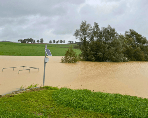
Heavy rain in Styria, flooding in Salzburg, mudslides in Carinthia – you can count yourself lucky if you are spared. But luck is often short-lived, as heavy rainfall events are becoming more frequent.
It is not only houses on rivers and streams that are at risk. Many more buildings are at risk of flooding from water running down hillsides. It rains in torrents, the water rushes down the slope with a force that can crush doors and flood cellars in an instant. The water carries fine sediment with it, clogging pipes and drains.
The inhabitants of the communities of St. Leonhard am Forst and Ruprechtshofen in Lower Austria know this situation only too well. Once the water is in the stream or river, it’s almost too late.
Solution
The early warning system for small regional floods is designed to deal with such situations. The warning system gives people and emergency services 15 to 30 valuable minutes to get themselves and their most important belongings out of harm’s way.
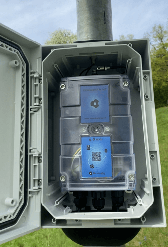
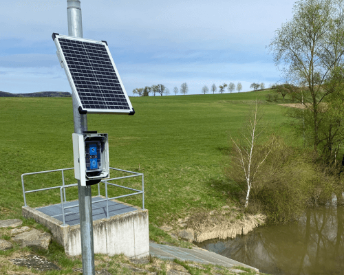
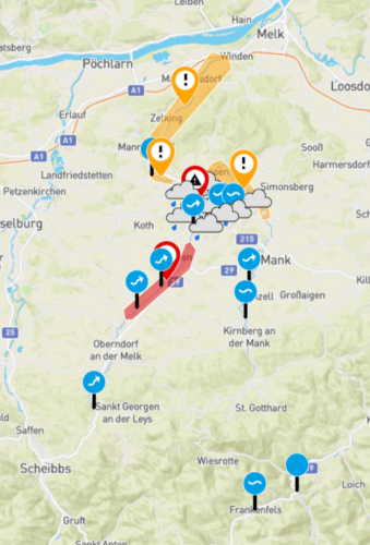
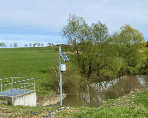
The pilot project covers five square kilometres in the Dangelsbach area. Twelve networked monitoring stations have been installed in this area in 2024, including three water level gauges, six precipitation gauges, one soil moisture gauge and three rain sensors. The gauges use sensors and AI-based algorithms to analyse the data.
Compared to existing systems, which focus mainly on large rivers such as the Danube and operate at relatively slow measurement intervals of around 15 minutes, this system is based on a much faster collection of relevant data. The sensors measure the current rainfall and water levels in the region in less than a minute and compare them with the maximum capacity of the area. The system automatically issues a warning if the set limits are exceeded. The data collected, such as rainfall, water levels and soil moisture, is made available on the website wasserstand.info, a free service from Microtronics.
In addition to wasserstand.info, Microtronics is responsible for the technical side of the project, including sensors, instruments, data transmission and implementation. The EPZ (Natural Hazard Prevention Centre) is involved as a partner. As an expert in natural hazard management, Dr Hans Starl is contributing his know-how to the project. The pilot project is supported by the Vienna University of Technology, BOKU and the Province of Lower Austria. Funding was provided by the Province of Lower Austria.